Our Recommended Walks
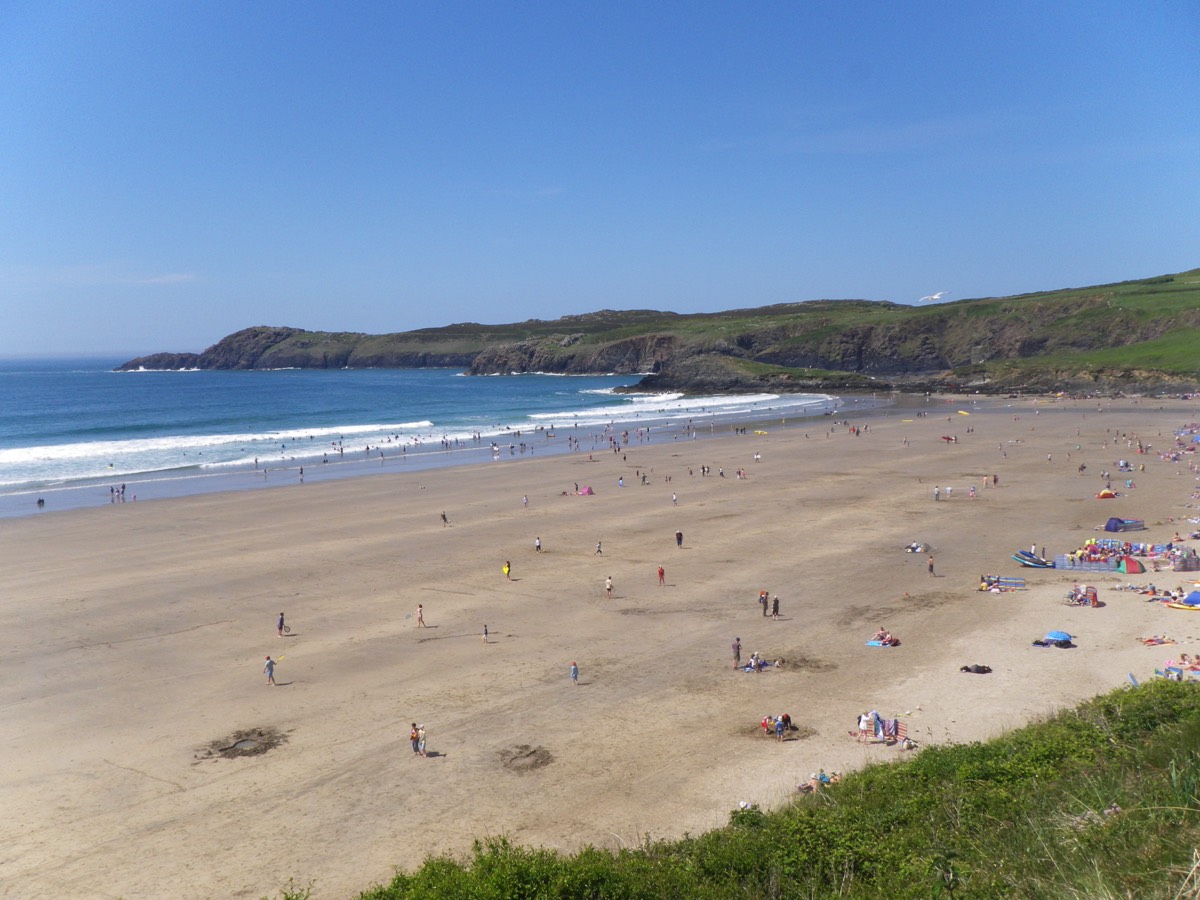
To Whitesands Beach
This route avoids the sometimes busy B4583. Turn left out of the property, when the tarmac runs out turn right down the footpath.
Distance 1km, 9 minutes. Click here to see this walk on OS Maps.
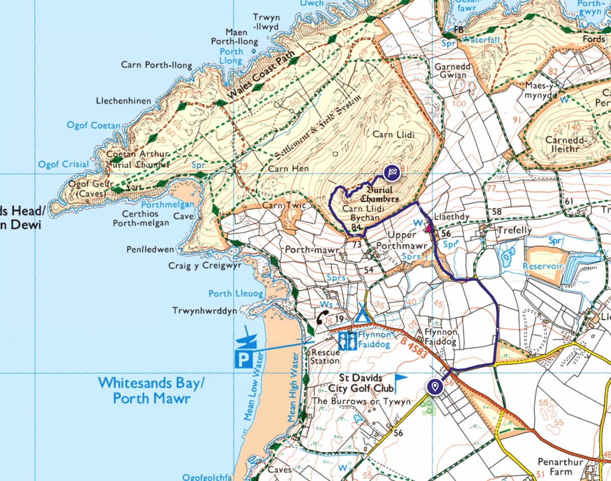
To Carn Llidi Summit
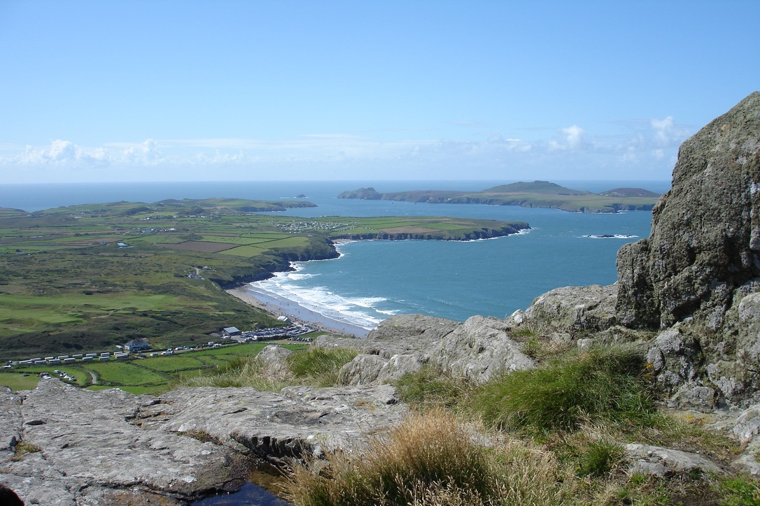
Carn Llidi is the igneous intrusive gabbro rock which dominates the skyline approximately 1km north west of the campsite. This route avoids the sometimes busy B4583 beach road, passes by the youth hostel and Upper Porthmawr. The final part of the walk is a moderately difficult scramble before summiting at 181m.
Distance 2.61km, 38 minutes. Click here to see this walk on OS Maps.
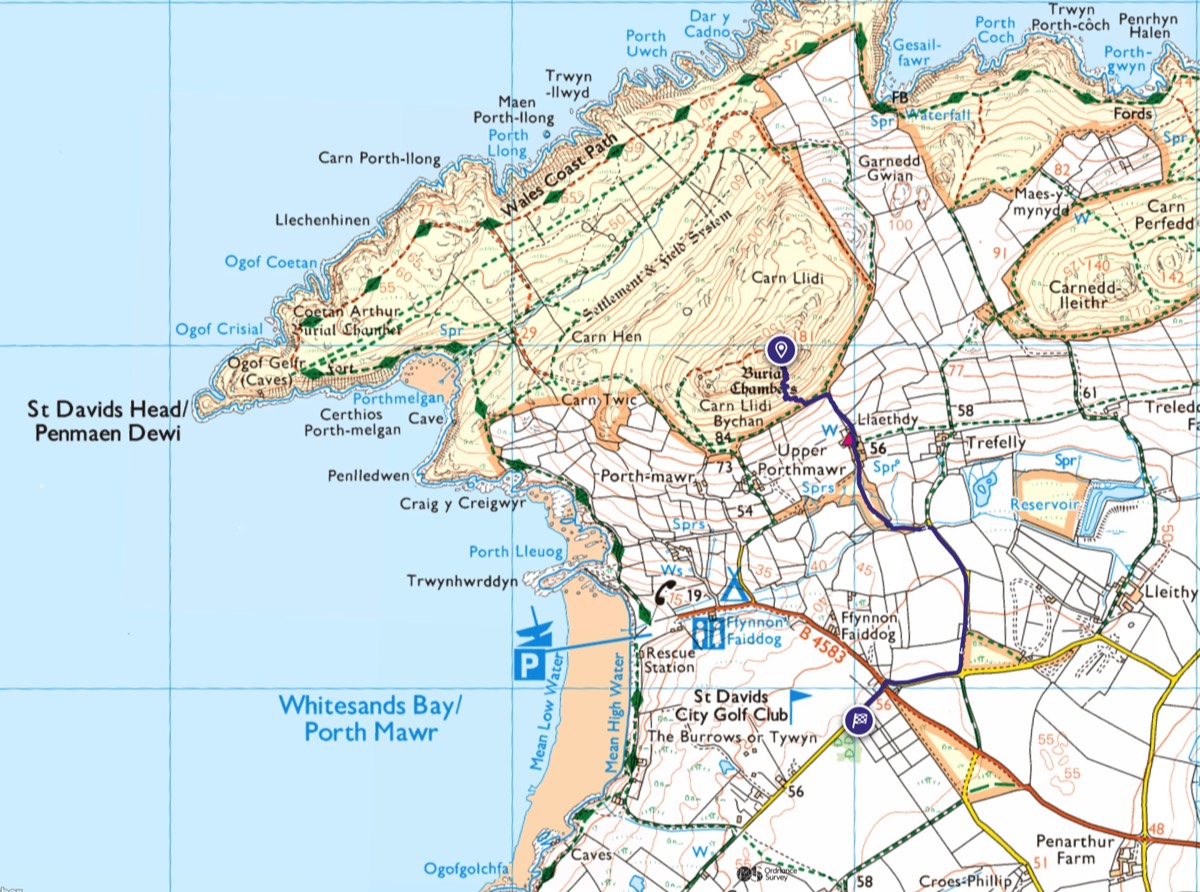
Carn Llidi Descent
Either retrace your steps or take the most direct route down by following paths made by the wild ponies, straight down the south western flank. Sturdy boots and tough trousers are recommended for protection from the prickly gorse!
Distance 1.89km, 24 minutes. Click here to see this walk on OS Maps.
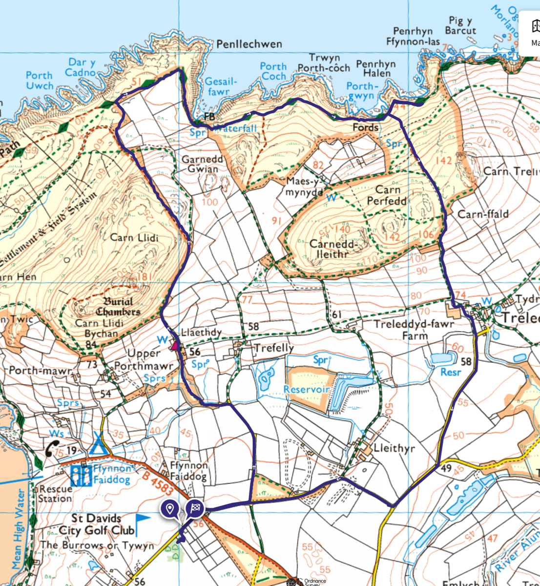
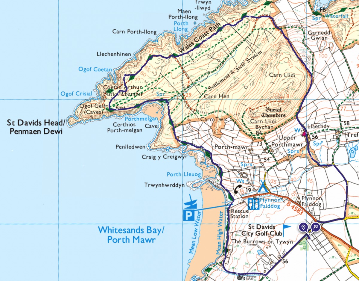
Carn Llidi and St Davids Head
Probably our favourite walk, affectionately known to us as the "Lockdown Walk". This walk heads up past the youth hostel, encircling Carn Llidi before heading out towards St Davids Head and back to Craig-Y-Mor via Whitesands Beach.
Distance 7.55km, 2 hours. Click here to see this walk on OS Maps.
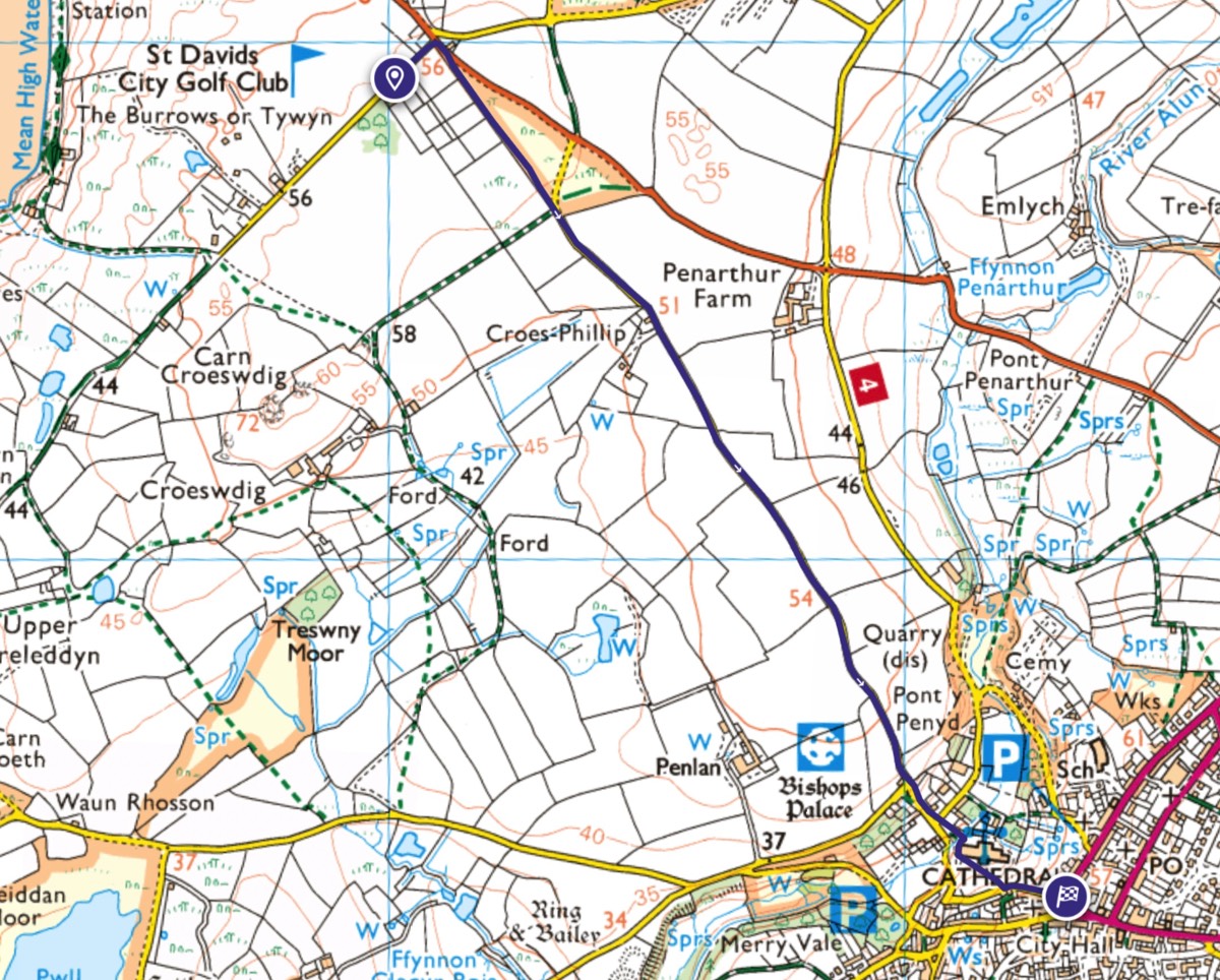
To St.Davids
This is the most direct walk to St. Davids following the quiet back road through the Cathedral grounds and up the 39 steps to the Pebbles before arriving at the St.Davids Cross Square.
Distance 2.29km, approximate time 25 minutes. Click here to see this walk on OS Maps.
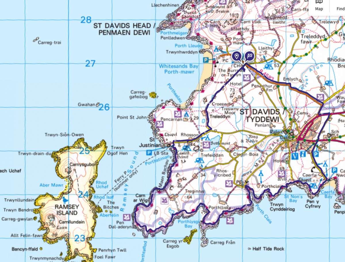
Southern Coastal Walk
This a whole day walk taking the Pembrokeshire Coast Path down the Ramsey Sound and passing by Portllisky, Porthclais, St. Nons and Caefai before heading inland to St. Davids and returning to Whitesands. The beach at Porthllisky is a lovely spot for lunch. Distance 19.64km, approximate time 5 hours. Click here to see this walk on OS Maps.
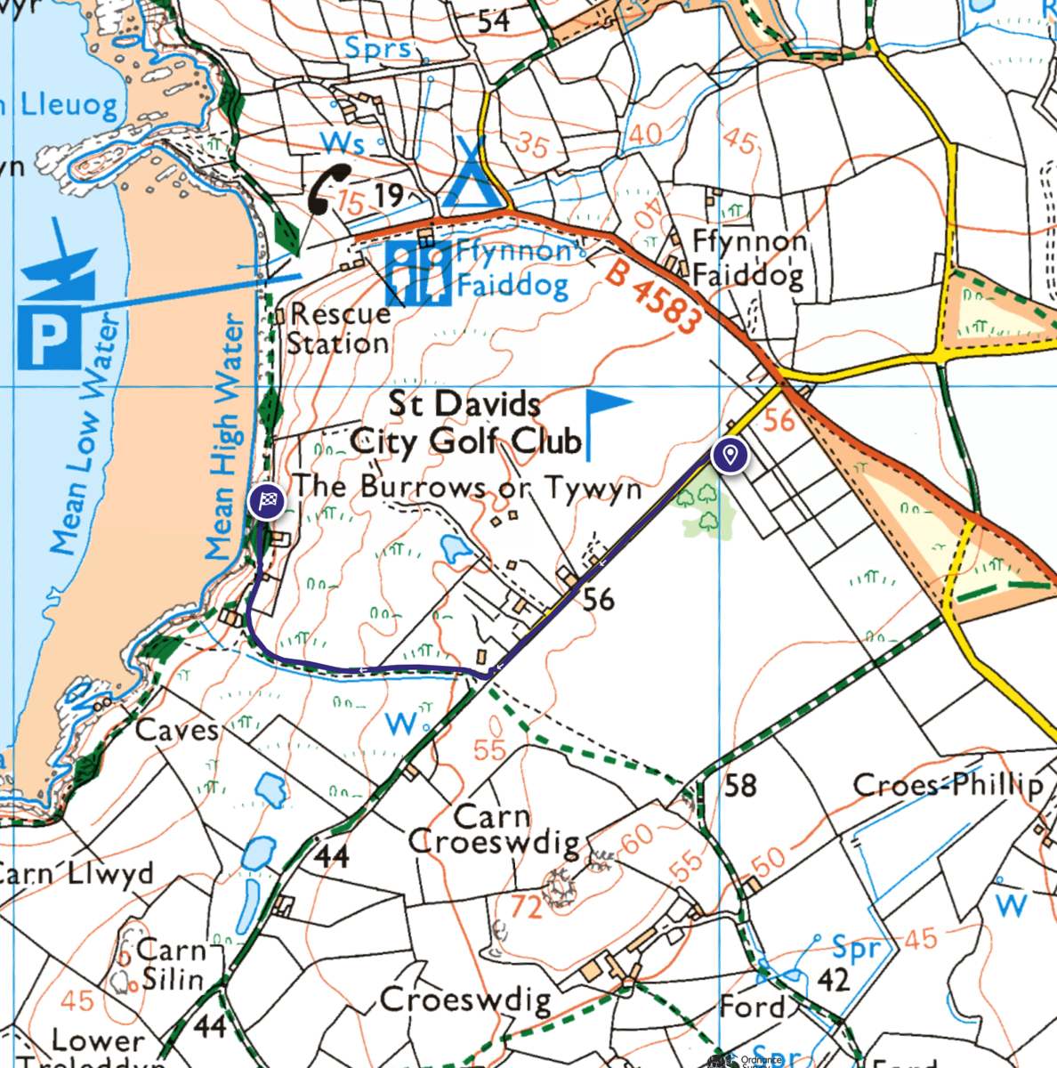
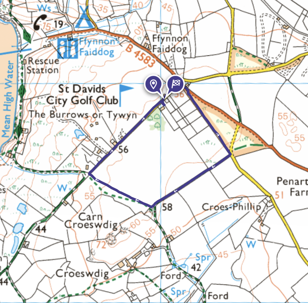
Tywyn Common Block Walk
A short walk round the block. Distance 1.87km, approximate time 0.5 hours. Click here to see this walk on OS Maps.
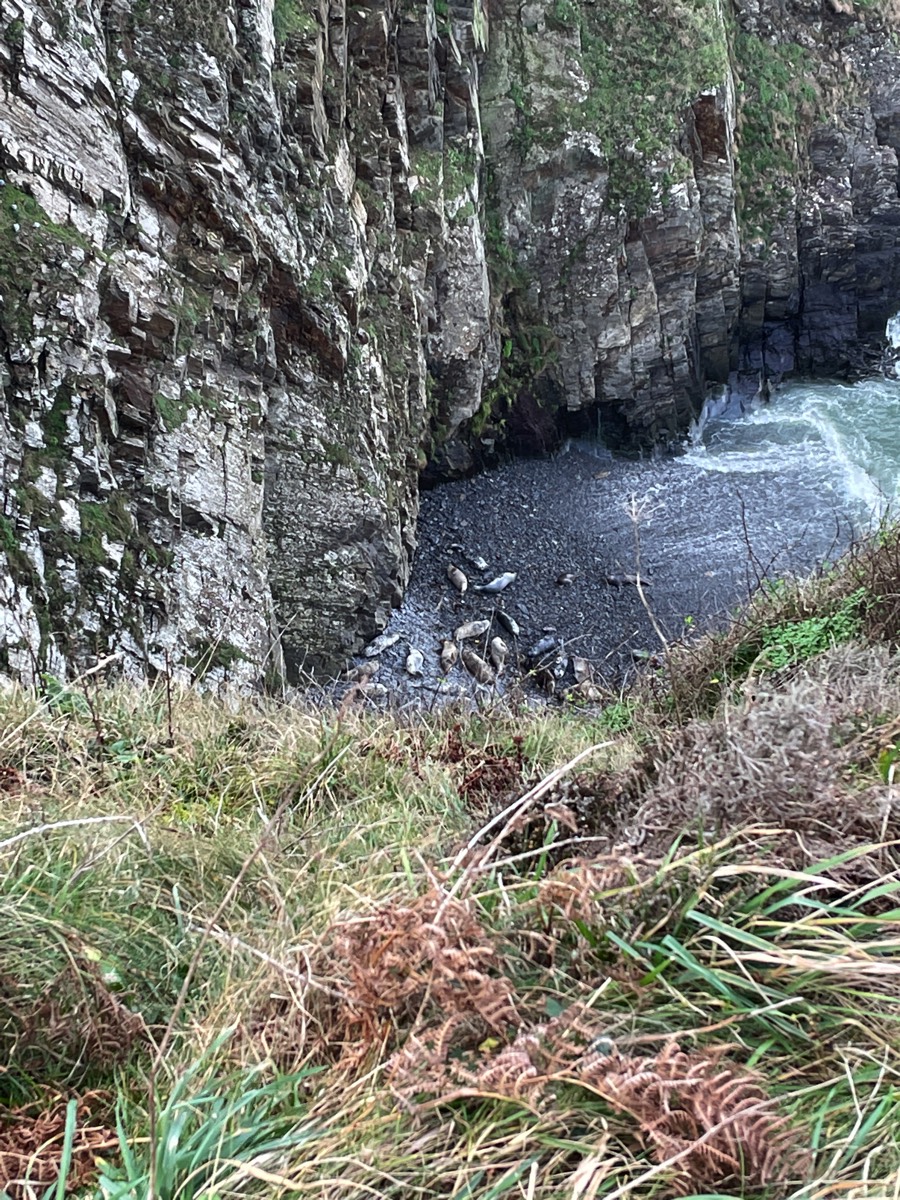
Seal Bay
Gesail fawr is a storm beach inaccessible by foot, protected on either side by high steep sided cliffs making it the perfect breeding ground and resting spot for the common Grey seal. Head east out of the campsite across the cross roads at the B4583 then take the next left and head up to the Youth Hostel. Follow the footpath over the saddle and down to the north Pembrokeshire Coast Path. Head east along the coast path, Gesail fawr (Seal Bay) is the first bay you come to. Distance 8km, approximate time 2.0 hours. Click here to see this walk on OS Maps.